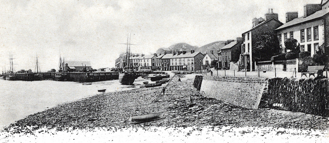
History of Aberdovey
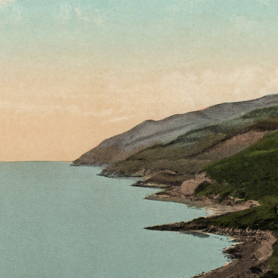
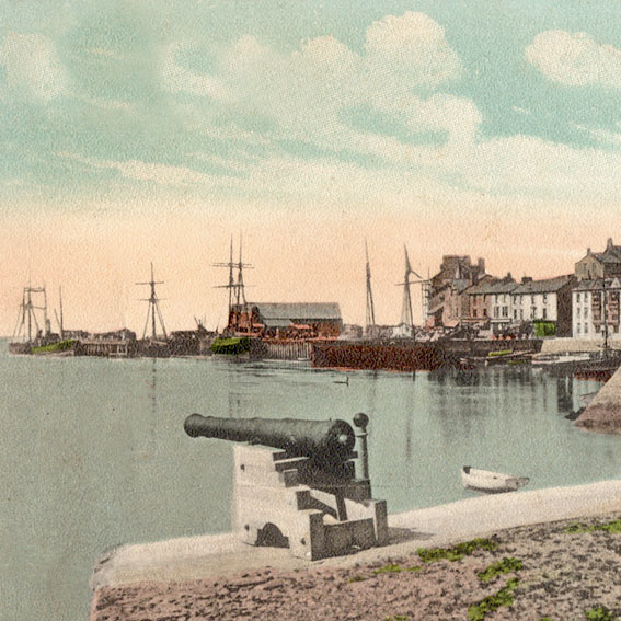
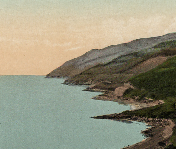
Who first gazed over the wide expanse of the River Dyfi and wondered how to cross? Or travelled from the east to the natural harbour ready to sail west along Celtic shore?
Aberdovey has certainly been a place of transit and situated on the north south divide of Wales, a place of meeting.
Prince Maelgwyn Gwynedd gathered the Welsh leaders here in 547 – the beach Traeth Maelgwyn is named after him on the south side of the estuary.
1188 sees the last mention of the ferry when Gerald of Wales on his journey through Wales drumming up support for the third Crusade records crossing the Dyfi on a ferry.
1216 sees Llywelyn Fawr (The Great) gathering most of the Princes of Wales to Aberdovey to assert his over-lordship, perhaps the first Welsh Senedd, or parliament. Llywelyn Fawr married Joan, daughter of King John of England.
Yet after the royal excitement of the 13th Century, by the 16th Century we see that Aberdovey is described in a report of the havens and creeks of Merionneth as ‘Devye, being a haven having no habitation but only 3 houses’. At least 2 of these were on the site of today’s Scrubadub and Aberdyfi Village Stores.
Apart from the incursion of a Spanish warship – the Bear of Amsterdam – seeking refuge and being trapped in the Dyfi Estuary in 1597 and the annual fleet fishing for herring – Aberdovey was indeed a sleepy location.
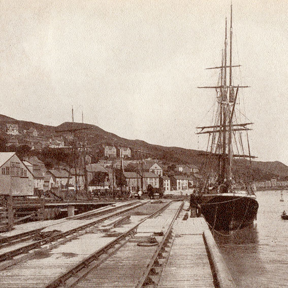
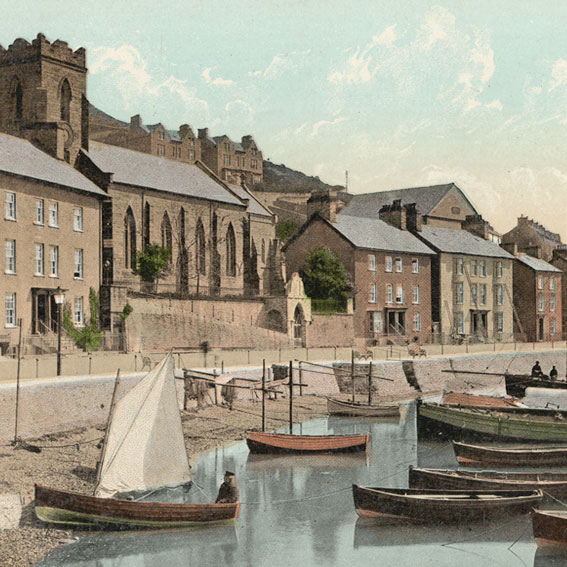
It was the demands of the industrial revolution that came to put Aberdovey on the map. Lead ore and other minerals from Cardiganshire and Montgomeryshire, oak and oak bark, and of course later, slate – all had to be shipped out to all corners of Britain and beyond.
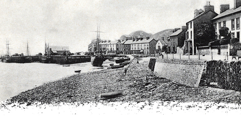
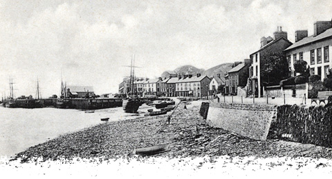
And so began the glorious but brief era of shipbuilding and commerce. At it’s height there were seven shipyards, six in the Penhelig area and one at the beach at Bodfor Terrace.
The most able of the ship builders was Thomas Richards, building 14 ships between 1858 and 1880. The beautiful Maglona sailed in the Newfoundland cod trade, sailing from Aberdovey to the Mediterranean, crossing the Atlantic and back to Europe, before returning to Aberdovey.
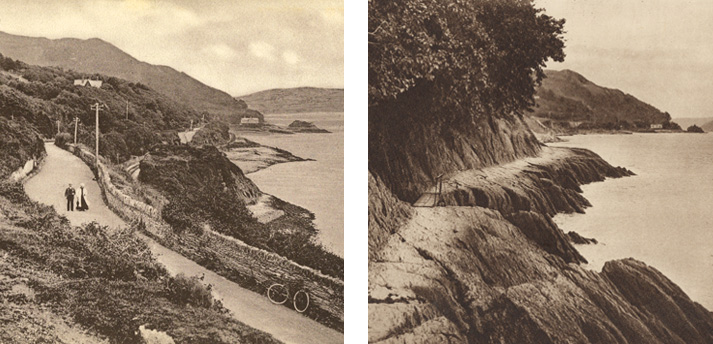
By 1827 the Turnpike Trust realised the port was expanding and built the present coast road. An earlier road had been built in 1808 but had not survived as it had been washed away by the tide – the present day Roman Road.
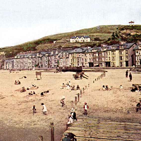
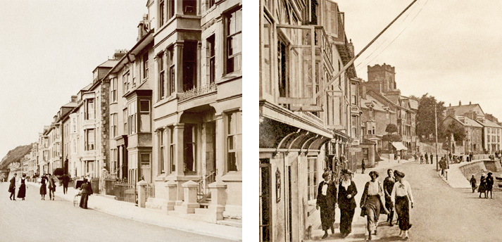
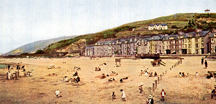
The arrival of the railway in 1864 signalled the beginning of the end for shipping and shipbuilding. By 1905 only one locally built ship remained, fittingly, The Dyfi Belle, built by Thomas Richards. The railway opened up a new part of Aberdovey’s history, that of tourism, which we enjoy to this day.
Author Dai Roberts, Aberdovey resident
History of Aberdovey
Who first gazed over the wide expanse of the River Dyfi and wondered how to cross? Or travelled from the east to the natural harbour ready to sail west along Celtic shore?
Aberdovey has certainly been a place of transit and situated on the north south divide of Wales, a place of meeting.
Prince Maelgwyn Gwynedd gathered the Welsh leaders here in 547 – the beach Traeth Maelgwyn is named after him on the south side of the estuary.
1188 sees the last mention of the ferry when Gerald of Wales on his journey through Wales drumming up support for the third Crusade records crossing the Dyfi on a ferry.
1216 sees Llywelyn Fawr (The Great) gathering most of the Princes of Wales to Aberdovey to assert his over-lordship, perhaps the first Welsh Senedd, or parliament. Llywelyn Fawr married Joan, daughter of King John of England.
Yet after the royal excitement of the 13th Century, by the 16th Century we see that Aberdovey is described in a report of the havens and creeks of Merionneth as ‘Devye, being a haven having no habitation but only 3 houses’. At least 2 of these were on the site of today’s Scrubadub and Aberdyfi Village Stores.
Apart from the incursion of a Spanish warship – the Bear of Amsterdam – seeking refuge and being trapped in the Dyfi Estuary in 1597 and the annual fleet fishing for herring – Aberdovey was indeed a sleepy location.
It was the demands of the industrial revolution that came to put Aberdovey on the map. Lead ore and other minerals from Cardiganshire and Montgomeryshire, oak and oak bark, and of course later, slate – all had to be shipped out to all corners of Britain and beyond.
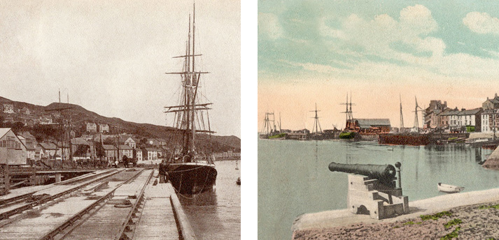
And so began the glorious but brief era of shipbuilding and commerce. At it’s height there were seven shipyards, six in the Penhelig area and one at the beach at Bodfor Terrace.
The most able of the ship builders was Thomas Richards, building 14 ships between 1858 and 1880. The beautiful Maglona sailed in the Newfoundland cod trade, sailing from Aberdovey to the Mediterranean, crossing the Atlantic and back to Europe, before returning to Aberdovey.

By 1827 the Turnpike Trust realised the port was expanding and built the present coast road. An earlier road had been built in 1808 but had not survived as it had been washed away by the tide – the present day Roman Road.
The arrival of the railway in 1864 signalled the beginning of the end for shipping and shipbuilding. By 1905 only one locally built ship remained, fittingly, The Dyfi Belle, built by Thomas Richards. The railway opened up a new part of Aberdovey’s history, that of tourism, which we enjoy to this day.
Author Dai Roberts, Aberdovey resident

History of Aberdovey
Who first gazed over the wide expanse of the River Dyfi and wondered how to cross? Or travelled from the east to the natural harbour ready to sail west along Celtic shore?
Aberdovey has certainly been a place of transit and situated on the north south divide of Wales, a place of meeting.
Prince Maelgwyn Gwynedd gathered the Welsh leaders here in 547 – the beach Traeth Maelgwyn is named after him on the south side of the estuary.
1188 sees the last mention of the ferry when Gerald of Wales on his journey through Wales drumming up support for the third Crusade records crossing the Dyfi on a ferry.
1216 sees Llywelyn Fawr (The Great) gathering most of the Princes of Wales to Aberdovey to assert his over-lordship, perhaps the first Welsh Senedd, or parliament. Llywelyn Fawr married Joan, daughter of King John of England.
Yet after the royal excitement of the 13th Century, by the 16th Century we see that Aberdovey is described in a report of the havens and creeks of Merionneth as ‘Devye, being a haven having no habitation but only 3 houses’. At least 2 of these were on the site of today’s Scrubadub and Aberdyfi Village Stores.
Apart from the incursion of a Spanish warship – the Bear of Amsterdam – seeking refuge and being trapped in the Dyfi Estuary in 1597 and the annual fleet fishing for herring – Aberdovey was indeed a sleepy location.
It was the demands of the industrial revolution that came to put Aberdovey on the map. Lead ore and other minerals from Cardiganshire and Montgomeryshire, oak and oak bark, and of course later, slate – all had to be shipped out to all corners of Britain and beyond.

And so began the glorious but brief era of shipbuilding and commerce. At it’s height there were seven shipyards, six in the Penhelig area and one at the beach at Bodfor Terrace.
The most able of the ship builders was Thomas Richards, building 14 ships between 1858 and 1880. The beautiful Maglona sailed in the Newfoundland cod trade, sailing from Aberdovey to the Mediterranean, crossing the Atlantic and back to Europe, before returning to Aberdovey.

By 1827 the Turnpike Trust realised the port was expanding and built the present coast road. An earlier road had been built in 1808 but had not survived as it had been washed away by the tide – the present day Roman Road.
The arrival of the railway in 1864 signalled the beginning of the end for shipping and shipbuilding. By 1905 only one locally built ship remained, fittingly, The Dyfi Belle, built by Thomas Richards. The railway opened up a new part of Aberdovey’s history, that of tourism, which we enjoy to this day.
Author Dai Roberts, Aberdovey resident


YOU MAY ALSO LIKE…